
BY CORY MORRISON
In like a lamb and out like a lion. This sums up January 2019’s weather in the Greater Toronto Area.
December’s lack of cold and snow continuing into early January had many people wondering if winter would be cancelled this year. However, winter eventually arrived abruptly. The last week of January was especially cold and snowy.
Adam Stiles, a meteorologist at CityNews Toronto, said in an email interview that the polar jet stream’s position has been the main factor in how much mild and cold air we have seen.
“When we were experiencing warmer than average temperatures, it was positioned well to the north,” he said. “At that time, parts of Europe dealt with deadly cold and extreme snowfall.”
The pattern did eventually change across much of the globe.
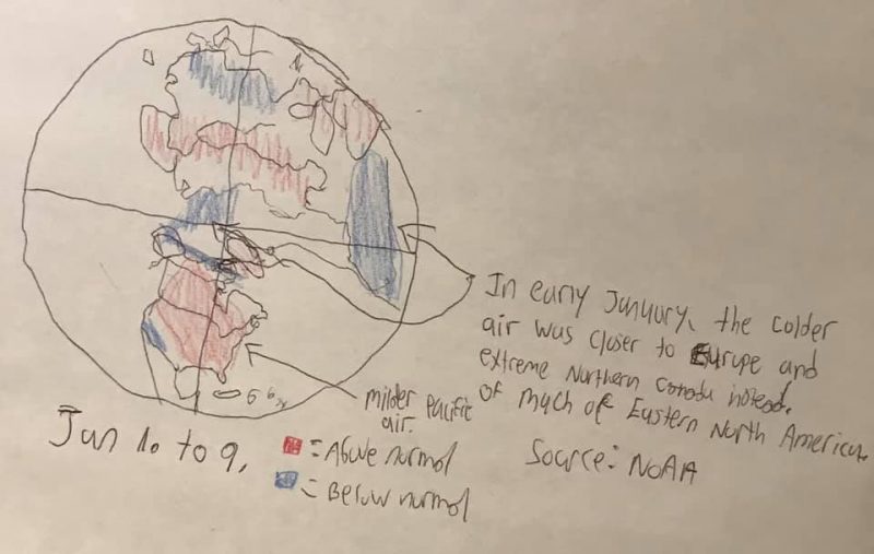
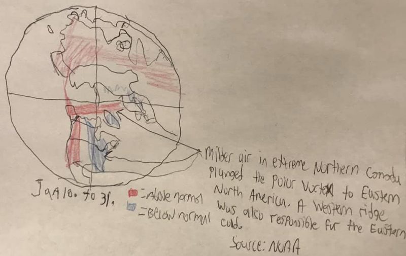
“There was a weaker polar vortex circulation around the Arctic at mid-month,” Stiles said. “That allowed the cold upper air circulation to sink south and bring frigid air along with it. Most of the winter, the polar vortex is strong and closer to the North Pole. Typically, if it is warmer in one spot, it will be colder in another.”
Some GTA weather highlights in the past month include:
- Coldest January in four years
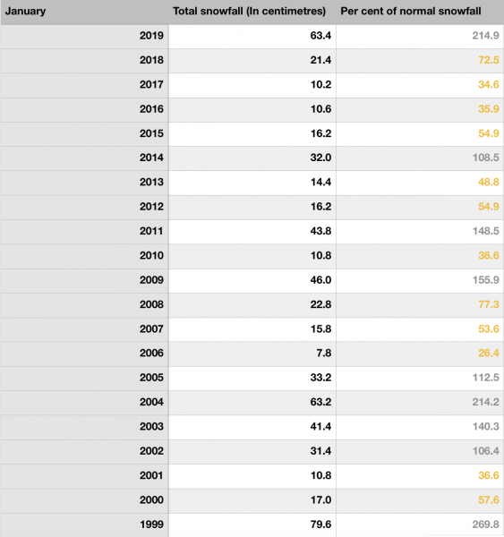
- Snowiest January in 20 years
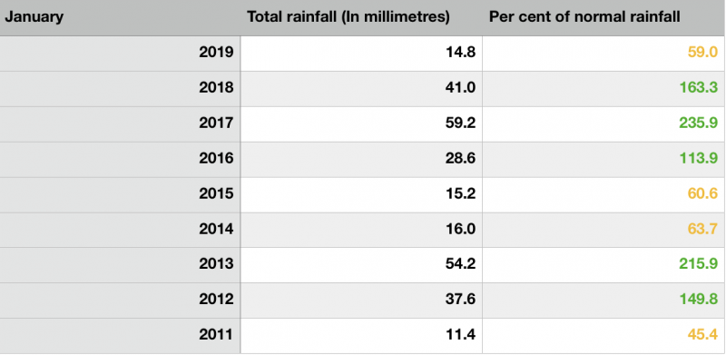
- Least rainiest January in eight years
- Jan. 8: the warmest day with a maximum temperature of 8.2 C and a minimum temperature of 2.4 C
- Jan. 23: the rainiest day with 7.2 millimetres of rainfall
- Jan. 25: the highest wind gust of 72 km/h
- Jan. 28: the snowiest day with 26.4 centimetres of snowfall
- Jan. 30: the coldest day with a maximum temperature of -15.4 C and a minimum temperature of -22.6 C
- Jan. 31: the coldest night with a minimum temperature of -22.8 C
The numbers include:
- An average maximum temperature of -2.3 C, which is 0.8 C colder than the 1981-2010 30-year-average at Toronto Pearson International Airport.
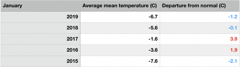
- An average mean temperature of -6.7 C, which is 1.2 C colder than average.
- An average minimum temperature of -11.0 C, which is 1.6 C colder than average.
- 63.4 centimetres of snowfall, which is 215 per cent of the normal amount of 29.5 centimetres.
- 14.8 millimetres of rainfall, which is 59 per cent of the normal amount of 25.1 millimetres.
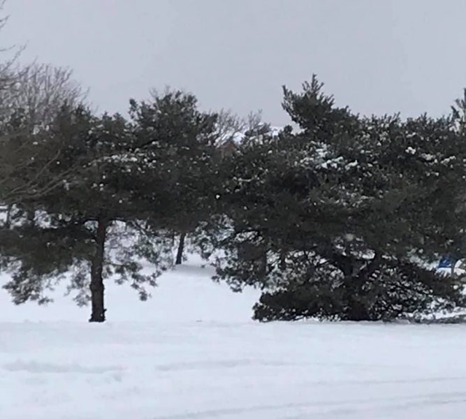
This video shows heavy snow outside Sheridan Trafalgar Campus on Jan. 28 before noon.
VIDEO BY CORY MORRISON
The extreme cold and snow is gone, as we now have spring-like temperatures. Winter is far from over despite this brief break.